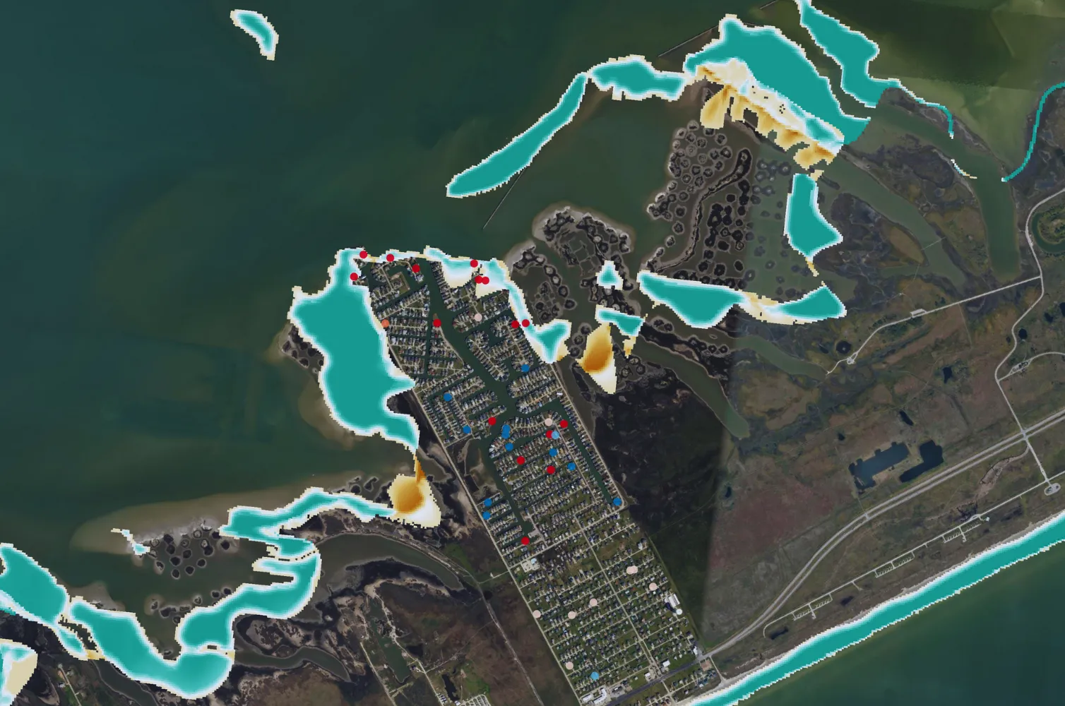
Newsletter

Stay up to date with everything that's happening in the world of Ocean Ledger.

Who we help
Insurance

As secondary perils overtake primary perils in insured losses, Ocean Ledger enables precision and nuance for catastrophe modeling to ultimately empower smarter risk selection, pricing, and asset valuation.

$181B

Is the protection gap from 2024 natural disasters as 57% of losses were uninsured.

$9M

Is the overestimation of property value at risk Ocean Ledger identified in Myrtle Beach, US.

±100 m

Are the shoreline shifts Ocean Ledger observed against a cat modelling vendor, influencing over or under-estimated losses.
What we do to help

Our insights offer precise, easy-to-update scenarios, forecasts, and risk assessments for storm surge, erosion, and sea-level rise impacts.

We leverage a suite of high-resolution satellite-derived data products that capture seabed depth, shoreline movement, and coastal defenses, enabling accurate underwriting of properties, infrastructure and ports located within 5 km of the shoreline and exposed to surge risk from storms and tsunamis.

Identify over- & under-estimated surge risk
By measuring shoreline position, change and coastal defenses in-house, we provide a nuanced and latest view of surge vulnerability for competitive underwriting, meaningful coverholder engagement and proactive reinsurance allocation.
Nuanced & comparable outputs to adjust AAL
Depending on internal and external models or dataset workflows, we provide stand-alone elevation data, surge depth, damage and EP curves with calculated % deltas based on the 'starting view' of surge risk. We collaborate with leading cat vendors like KatRrisk.
Flexibility, forecasting & frequent updates
We connect across the risk cycle, providing surge insight for traditional and parametric insurance as well as site-based risk management. By integrating deep-dive assessments, portfolio monitoring, and risk transfer support, we strengthen resilience and improves decision-making for all stakeholders.

Ready to get started?

Questions?

Contact us for any questions or
to start a new project.

Get in touch
Case Studies

See past relevant projects
and case studies.

Download
FAQs

Frequently Asked Questions

View all

Accuracy

  • Open-source tools and datasets are incredibly valuable resources and can be a good starting point, depending on budget and project scale. However, they often contain data and time gaps, and their accuracy breaks down when applied at local scales.
  • Ocean Ledger fills these gaps with spatially accurate, frequently updated data — particularly useful for projects tied to financial instruments (e.g. biodiversity credits), which demand up-to-date and verifiable baselines.

Usability

  • Open-source data can typically be downloaded, but it often lacks flexibility for deeper manipulation.
  • Ocean Ledger delivers precise, forecastable data tailored to user needs — and enables integration of field data for comprehensive, context-specific analysis.

Monitoring

  • National open datasets are usually updated every 5–10 years, with limited projections and low transparency.
  • Ocean Ledger updates every 6 days, provides high-resolution forecasts (every 50–100m), and includes uncertainty maps to support rapid decision-making for changing coastal conditions.

Transparency

  • Open data may reference accuracy metrics but rarely discloses full model uncertainties.
  • Ocean Ledger provides spatial and temporal uncertainty metrics, F1 scores, and performance data for every model and output.

We distinguish between Primary Satellite-Derived Data Products and Advanced Insights. The latter are enhanced outputs that build upon or integrate the core insights from the Primary Products to deliver deeper, more actionable insights.

Currently, our available data products include:

  • Primary Satellite-Derived Data Products
  • Advanced Insights (enhanced outputs that build on core products for deeper analysis)


Please get in touch to request our latest Tech Report for more information on each data product.

This is the main interface between Ocean Ledger and its clients. Built in-house, the dashboard offers:

  • Seamless access (API, raw data downloads) to spatial data products for erosion, bathymetry, natural capital
  • Heatmap analysis (with customisable thresholds) to identify erosion, storm surge and ecosystem degradation
  • Standardised & Custom Solutions for Scenario Analysis, Climate Modelling & Restoration Uplift
  • Trigger thresholds for early warning and risk mitigation
  • Accurate baselines and continuous monitoring
  • Transparency on data sources, accuracy, and uncertainty metrics

Yes! Please fill out our online form, and we’ll get back to you with options to demonstrate our solution for your project.

Most flood-risk and cat risk providers leverage the same digital elevation models (DEM’s). Ocean Ledger provides a next-generation DEM that fuses bathymetry, shoreline and natural defenses, which are key variables in identifying where there is more or less storm surge risk along a coastline.