Newsletter

Subscribe to our newsletter, The Littoral Lens, to dive into the latest trends on coastal risk modelling, engineering and resiliency efforts.

Who we help
Utilities

Protecting exposed critical communication and energy infrastructure through geospatial insights.

$5,600+ per minute

Is how much downtime costs a telecom operator.
What we do to help

Utilities, whether windfarms, subsea telecom cable or oil and gas energy pipeline, face a critical data blindspot at the shore-end, the highest-risk zone where pipelines and cables transition from nearshore waters to land.

The combination of new infrastructure development, coastal erosion, tidal sediment movement, and powerful storm surge makes shore-end risk both more expensive and less predictable. What was once a manageable engineering problem is becoming a persistent cost driver with fast-growing uncertainty.

As global demand for these essential utilities expands, traditional monitoring and repair services are struggling to keep pace while operators simply cannot afford the reputational and financial fallout of unplanned downtime.

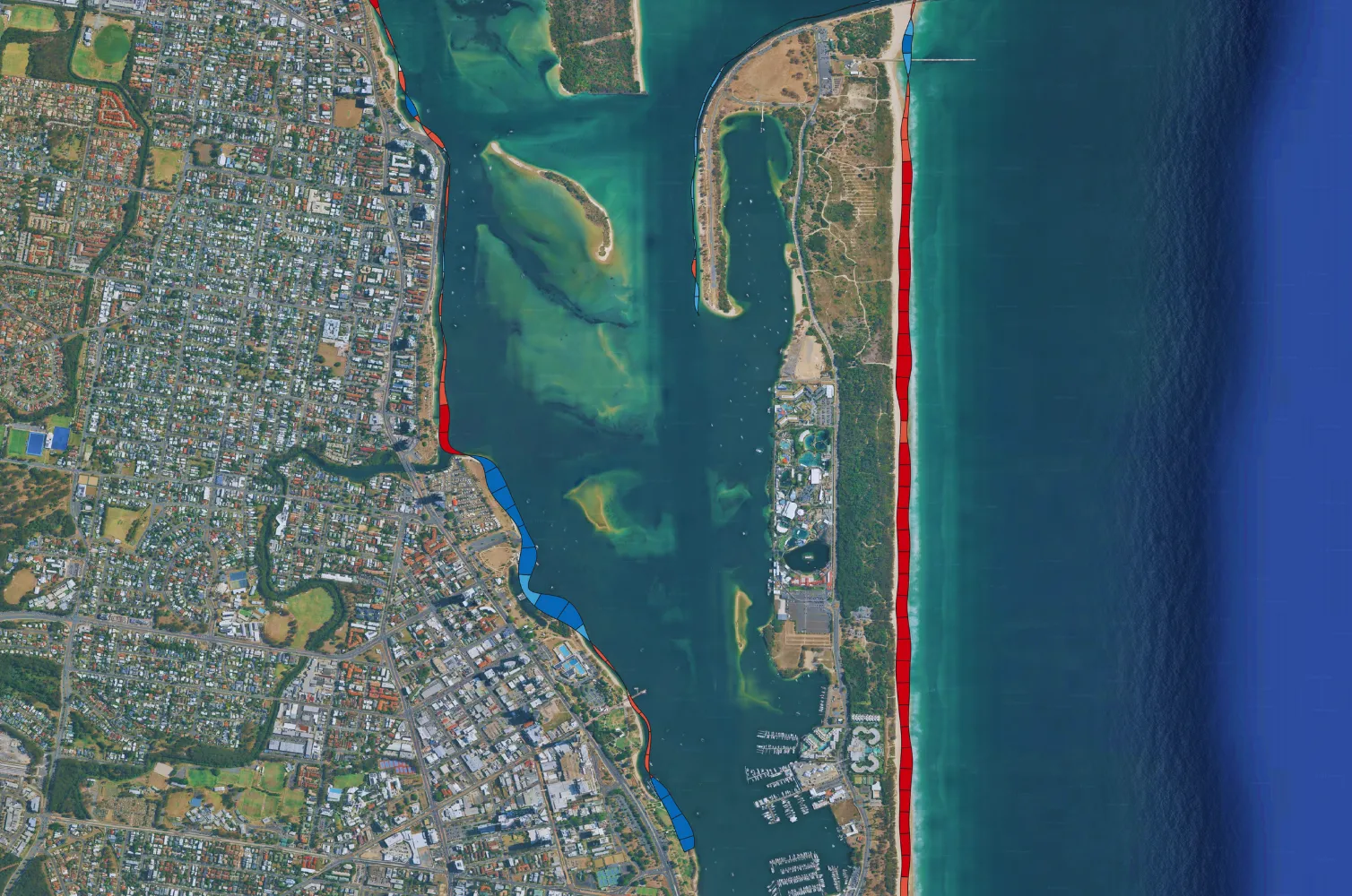
Vulnerabilities and rapid damage assessment
Ocean Ledger’s proprietary AI engine analyzes the coastal landing zone and surrounding approaches. Through satellite imagery, we extract historical shorelines to classify seabed dynamics, coastal defenses, and erosion patterns. Our insights support:

- Planning: Environmental intelligence for route design and risk mitigation.
- Operations: Continuous monitoring to detect subtle environmental changes.
- Event response: Rapid triage and ground-truth verification following severe weather.

Ready to get started?

Questions?

Contact us for any questions or
to start a new project.

Get in touch
Case Studies

See past relevant projects
and case studies.

Download