


Hurricane Beryl, the earliest Category 5 storm in decades, swept through the Caribbean and struck Texas last July. In addition to the tragic loss of lives, the storm caused an estimated $28–32 billion in economic damage. Coastal flooding was driven by erosion and storm surge.
Post-storm, the Texas General Land Office carried out surveys to report the damage to FEMA. They used LIDAR-based drone surveys collected over two months.
We looked at Galveston Island and produced our own damage assessment within a few hours (using satellite data only). We were able to derive results with aligned the high-resolution drone survey assessment.
We looked at shoreline change pre and post-hurricane.
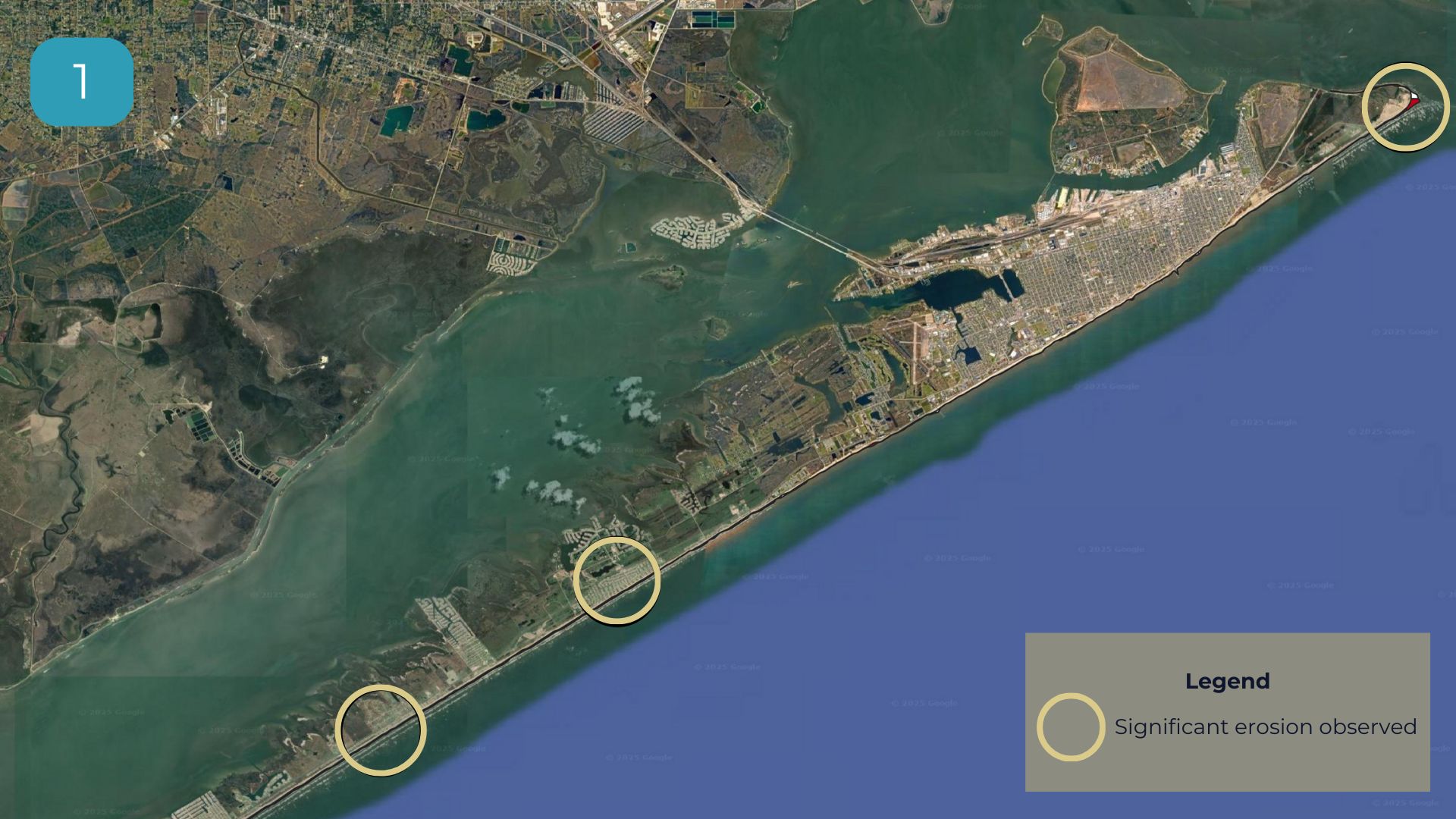
- Picture 1: Rapid Coastline Assessment. We identified three key erosion hotspots along the coast of Galveston Island.
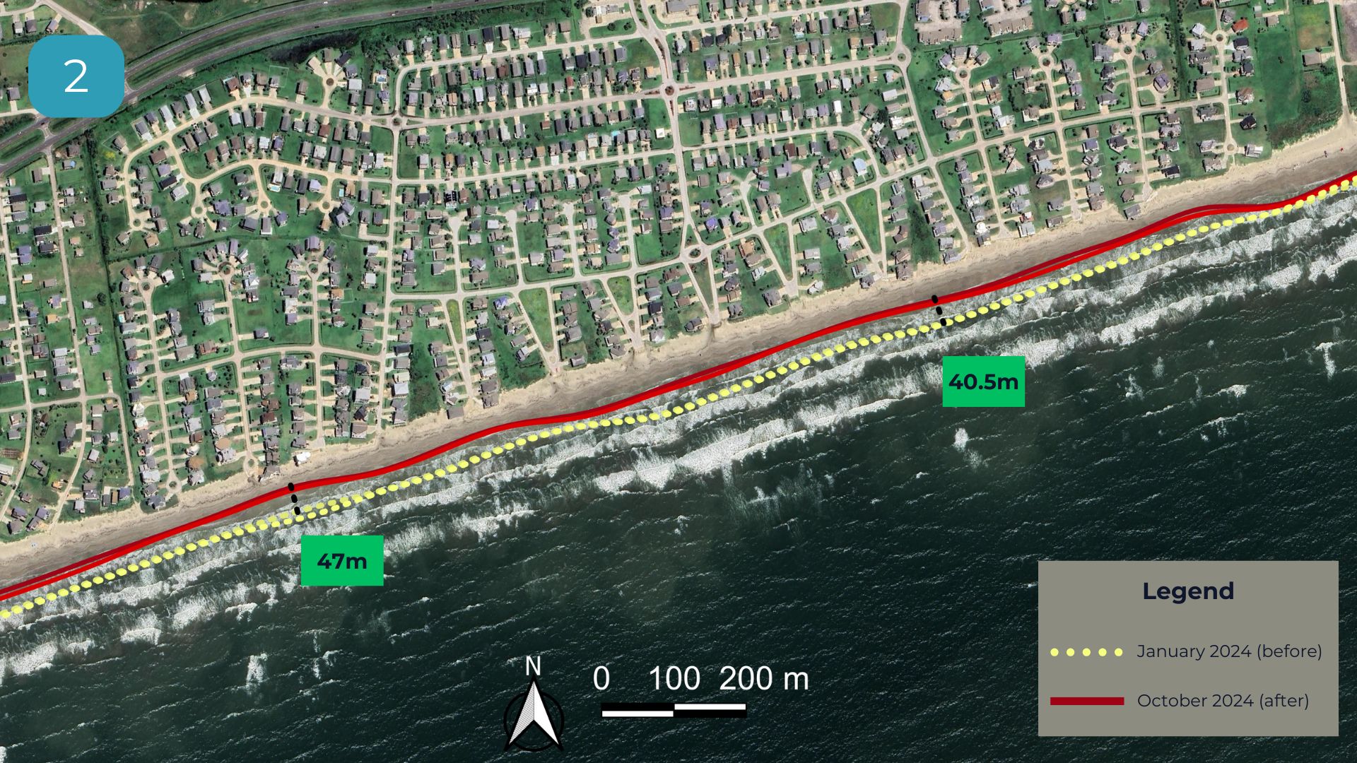
- Picture 2: Shoreline Retreat. Zoomed in on a hotspot where significant erosion is visible and measured a shoreline retreat reaching up to 47 meters (typical shoreline annual retreat in Texas is 1.7 meters).
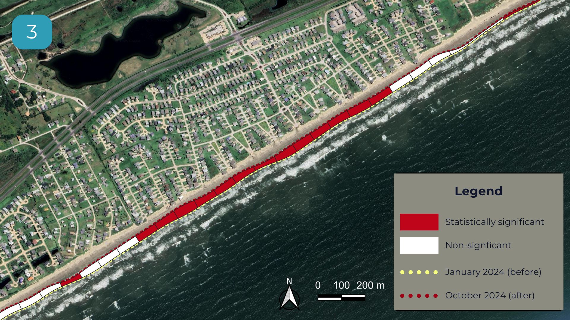
- Picture 3: Statistical Overay for Prioritisation. Areas highlighted in red indicate the zones most at risk of future flooding and should be prioritized for defenses. The white areas should be prioritized for ground-based assessment.
How we did it:
- Used Landsat imagery, selecting the clearest, cloud-free imagery.
- Performed shoreline annual transect extraction (every 100 meters).
- Applied tidal adjustment for consistency.
- Employed a statistical approach to detect abnormal erosion patterns relative to their surroundings.
- Results fall within a 95% confidence interval, indicating high certainty that the detected changes are statistically significant.
Note in Picture 3, this is not a replacement for any ground survey, but it is a robust feasibility assessment to 𝗿𝗲𝗱𝘂𝗰𝗲 and 𝘁𝗮𝗿𝗴𝗲𝘁 site surveys that require significantly larger budgets and take time.What makes this product unique is that because it's satellite-derived, the standardised spatial baseline can be updated every 6 days. So, when a hurricane is on route to Texas, local authorities and insurers can PREDICT, every 100 meters along the shoreline, where there might be vulnerabilities in sea defenses or highly eroded coastline susceptible to storm surge.
