
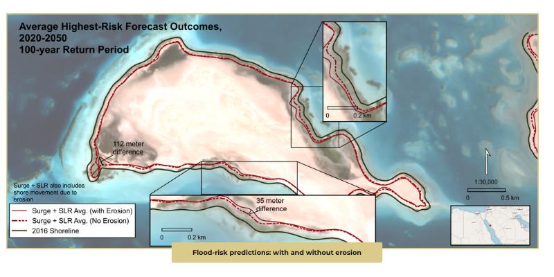
Most flood models or sea-level rise reports do not take into account the evolution of shoreline shape (elevation). Not factoring in the evolution of coastal morphology can significantly alter which global assets (natural or physical) are exposed to inundation. In other words, by not accounting for these variables, we are significantly underestimating or overestimating risk.
We illustrate here a striking relative difference when incorporating erosion into flood-risk predictions. How did we do this?
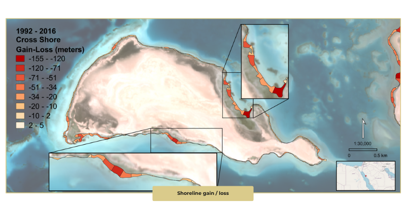
- Measured observed historical shoreline change (1992-2016) over ~18.5 km of shoreline in the Red Sea.
- Combined this with a standard slope value to forecast inundation from sea-level scenarios.
- Produced two risk scenarios: Surge + average sea level rise WITHOUT erosion (including shore movement due to erosion). Surge + average sea level rise WITH erosion (including shore movement due to erosion).
For insurers, this translates to risk-adjusted premiums and automated claims processing. For risk advisory, it can support proactive risk mitigation and bespoke placement, ensuring long-term cost savings.